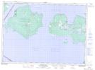
Maps showing Cockburn Island Indian Reserve 19, Manitoulin, Ontario
Cockburn Island Indian Reserve 19 is a Indian Reserve located in Manitoulin, Ontario.
- Latitude: 45° 58' North (decimal: 45.9666668)
- Longitude: 83° 25' West (decimal: -83.4166668)
- Topography Feature Category: Indian Reserve
- Geographical Feature: Indian Reserve
- Canadian Province/Territory: Ontario
- Location: Manitoulin
- Atlas of Canada Locator Map: Cockburn Island Indian Reserve 19
- GPS Coordinate Locator Map: Cockburn Island Indian Reserve 19 Lat/Long