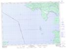
Maps showing Réserve indienne Obadjiwan 15E, Algoma, Ontario
Réserve indienne Obadjiwan 15E is a Indian Reserve located in Algoma, Ontario.
- Latitude: 46° 55' North (decimal: 46.9167000)
- Longitude: 84° 32' West (decimal: -84.5333000)
- Topography Feature Category: Indian Reserve
- Geographical Feature: Réserve indienne
- Canadian Province/Territory: Ontario
- Location: Algoma
- Atlas of Canada Locator Map: Réserve indienne Obadjiwan 15E
- GPS Coordinate Locator Map: Réserve indienne Obadjiwan 15E Lat/Long
Réserve indienne Obadjiwan 15E NTS Map Sheets