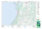
Maps showing Chief's Point Indian Reserve 28, Bruce, Ontario
Chief's Point Indian Reserve 28 is a Indian Reserve located in Bruce, Ontario.
- Latitude: 44° 40' North (decimal: 44.6666999)
- Longitude: 81° 17' West (decimal: -81.2833000)
- Topography Feature Category: Indian Reserve
- Geographical Feature: Indian Reserve
- Canadian Province/Territory: Ontario
- Location: Bruce
- Atlas of Canada Locator Map: Chief's Point Indian Reserve 28
- GPS Coordinate Locator Map: Chief's Point Indian Reserve 28 Lat/Long