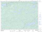
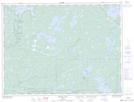
Maps showing Réserve indienne Sturgeon Falls 23, Rainy River, Ontario
Réserve indienne Sturgeon Falls 23 is a Indian Reserve located in Rainy River, Ontario.
- Latitude: 48° 44' 55'' North (decimal: 48.7486000)
- Longitude: 92° 21' 0'' West (decimal: -92.3500000)
- Topography Feature Category: Indian Reserve
- Geographical Feature: Réserve indienne
- Canadian Province/Territory: Ontario
- Location: Rainy River
- Atlas of Canada Locator Map: Réserve indienne Sturgeon Falls 23
- GPS Coordinate Locator Map: Réserve indienne Sturgeon Falls 23 Lat/Long
Réserve indienne Sturgeon Falls 23 NTS Map Sheets