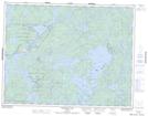
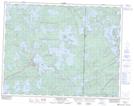
Maps showing Réserve indienne Islington 29, Kenora, Ontario
Réserve indienne Islington 29 is a Indian Reserve located in Kenora, Ontario.
- Latitude: 50° 10' North (decimal: 50.166667)
- Longitude: 94° 58' West (decimal: -94.966667)
- Topography Feature Category: Indian Reserve
- Geographical Feature: Réserve indienne
- Canadian Province/Territory: Ontario
- Location: Kenora
- Atlas of Canada Locator Map: Réserve indienne Islington 29
- GPS Coordinate Locator Map: Réserve indienne Islington 29 Lat/Long
Réserve indienne Islington 29 NTS Map Sheets