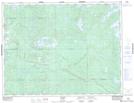
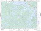
Maps showing Wabigoon Lake Indian Reserve 27, Kenora, Ontario
Wabigoon Lake Indian Reserve 27 is a Indian Reserve located in Kenora, Ontario and has an elevation of 383 meters.
- Latitude: 49° 36' North (decimal: 49.5999999)
- Longitude: 92° 32' West (decimal: -92.5333000)
- Topography Feature Category: Indian Reserve
- Geographical Feature: Indian Reserve
- Canadian Province/Territory: Ontario
- Elevation: 383 meters
- Location: Kenora
- Atlas of Canada Locator Map: Wabigoon Lake Indian Reserve 27
- GPS Coordinate Locator Map: Wabigoon Lake Indian Reserve 27 Lat/Long
Wabigoon Lake Indian Reserve 27 NTS Map Sheets