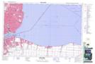
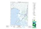
Maps showing Réserve indienne Walpole Island 46, Lambton, Ontario
Réserve indienne Walpole Island 46 is a Indian Reserve located in Lambton, Ontario.
- Latitude: 42° 33' North (decimal: 42.5500000)
- Longitude: 82° 31' West (decimal: -82.5166999)
- Topography Feature Category: Indian Reserve
- Geographical Feature: Réserve indienne
- Canadian Province/Territory: Ontario
- Location: Lambton
- Atlas of Canada Locator Map: Réserve indienne Walpole Island 46
- GPS Coordinate Locator Map: Réserve indienne Walpole Island 46 Lat/Long
Réserve indienne Walpole Island 46 NTS Map Sheets