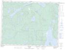
Maps showing Réserve indienne Gull River 55, Thunder Bay, Ontario
Réserve indienne Gull River 55 is a Indian Reserve located in Thunder Bay, Ontario.
- Latitude: 49° 49' North (decimal: 49.8166999)
- Longitude: 89° 8' West (decimal: -89.1332999)
- Topography Feature Category: Indian Reserve
- Geographical Feature: Réserve indienne
- Canadian Province/Territory: Ontario
- Location: Thunder Bay
- Atlas of Canada Locator Map: Réserve indienne Gull River 55
- GPS Coordinate Locator Map: Réserve indienne Gull River 55 Lat/Long