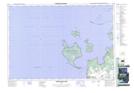
Maps showing Réserve indienne Christian Island 30A, Simcoe, Ontario
Réserve indienne Christian Island 30A is a Indian Reserve located in Simcoe, Ontario and has an elevation of 190 meters.
- Latitude: 44° 48' North (decimal: 44.7999999)
- Longitude: 80° 8' West (decimal: -80.1333000)
- Topography Feature Category: Indian Reserve
- Geographical Feature: Réserve indienne
- Canadian Province/Territory: Ontario
- Elevation: 190 meters
- Location: Simcoe
- Atlas of Canada Locator Map: Réserve indienne Christian Island 30A
- GPS Coordinate Locator Map: Réserve indienne Christian Island 30A Lat/Long
Réserve indienne Christian Island 30A NTS Map Sheets