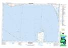
Maps showing Lake Henry, Essex, Ontario
Lake Henry is a Lake located in Essex, Ontario and has an elevation of 175 meters.
- Latitude: 41° 49' 43'' North (decimal: 41.8286111)
- Longitude: 82° 38' 20'' West (decimal: -82.6388888)
- Topography Feature Category: Lake
- Geographical Feature: Lake
- Canadian Province/Territory: Ontario
- Elevation: 175 meters
- Location: Essex
- Atlas of Canada Locator Map: Lake Henry
- GPS Coordinate Locator Map: Lake Henry Lat/Long
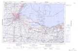
Lake Henry NTS Map Sheets