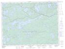
Maps showing Abiwin, Rainy River, Ontario
Abiwin is a Unincorporated area located in Rainy River, Ontario and has an elevation of 446 meters.
- Latitude: 48° 44' 40'' North (decimal: 48.7444444)
- Longitude: 91° 3' 59'' West (decimal: -91.0663888)
- Topography Feature Category: Unincorporated area
- Geographical Feature: Railway Point
- Canadian Province/Territory: Ontario
- Elevation: 446 meters
- Location: Rainy River
- Atlas of Canada Locator Map: Abiwin
- GPS Coordinate Locator Map: Abiwin Lat/Long
Abiwin NTS Map Sheets