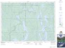
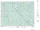
Maps showing Acadia, Sudbury, Ontario
Acadia is a Geographical area located in Sudbury, Ontario.
- Latitude: 47° 11' 47'' North (decimal: 47.1963888)
- Longitude: 80° 28' 3'' West (decimal: -80.4675000)
- Topography Feature Category: Geographical area
- Geographical Feature: Geographic Township
- Canadian Province/Territory: Ontario
- Location: Sudbury
- Atlas of Canada Locator Map: Acadia
- GPS Coordinate Locator Map: Acadia Lat/Long
Acadia NTS Map Sheets