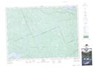
Maps showing Acanthus, Nipissing, Ontario
Acanthus is a Unincorporated area located in Nipissing, Ontario.
- Latitude: 46° 1' 51'' North (decimal: 46.0308333)
- Longitude: 78° 24' 16'' West (decimal: -78.4044444)
- Topography Feature Category: Unincorporated area
- Geographical Feature: Railway Point
- Canadian Province/Territory: Ontario
- Location: Nipissing
- Atlas of Canada Locator Map: Acanthus
- GPS Coordinate Locator Map: Acanthus Lat/Long