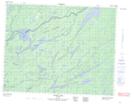
Maps showing Achapi Lake, Thunder Bay, Ontario
Achapi Lake is a Lake located in Thunder Bay, Ontario and has an elevation of 342 meters.
- Latitude: 51° 13' 33'' North (decimal: 51.2258333)
- Longitude: 89° 36' 43'' West (decimal: -89.6119444)
- Topography Feature Category: Lake
- Geographical Feature: Lake
- Canadian Province/Territory: Ontario
- Elevation: 342 meters
- Location: Thunder Bay
- Atlas of Canada Locator Map: Achapi Lake
- GPS Coordinate Locator Map: Achapi Lake Lat/Long
Achapi Lake NTS Map Sheets