Maps showing Albion Falls, Wentworth, Ontario
Albion Falls is a Unincorporated area located in Wentworth, Ontario and has an elevation of 187 meters.
- Latitude: 43° 11' 50'' North (decimal: 43.1972222)
- Longitude: 79° 49' 6'' West (decimal: -79.8183333)
- Topography Feature Category: Unincorporated area
- Geographical Feature: Urban Community
- Canadian Province/Territory: Ontario
- Elevation: 187 meters
- Location: Wentworth
- Atlas of Canada Locator Map: Albion Falls
- GPS Coordinate Locator Map: Albion Falls Lat/Long
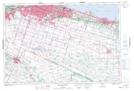
Albion Falls NTS Map Sheets