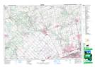
Maps showing Albion Hills, Peel, Ontario
Albion Hills is a Mountain located in Peel, Ontario and has an elevation of 348 meters.
- Latitude: 43° 54' 57'' North (decimal: 43.9158333)
- Longitude: 79° 53' 59'' West (decimal: -79.8997222)
- Topography Feature Category: Mountain
- Geographical Feature: Hills
- Canadian Province/Territory: Ontario
- Elevation: 348 meters
- Location: Peel
- Atlas of Canada Locator Map: Albion Hills
- GPS Coordinate Locator Map: Albion Hills Lat/Long