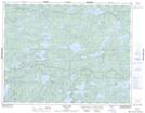
Maps showing Alexandra Lake, Kenora, Ontario
Alexandra Lake is a Lake located in Kenora, Ontario.
- Latitude: 49° 55' 0'' North (decimal: 49.9166999)
- Longitude: 93° 31' 30'' West (decimal: -93.5249999)
- Topography Feature Category: Lake
- Geographical Feature: Lake
- Canadian Province/Territory: Ontario
- Location: Kenora
- GPS Coordinate Locator Map: Alexandra Lake Lat/Long