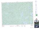
Maps showing Allen Rapids Portage, Nipissing, Ontario
Allen Rapids Portage is a Road feature located in Nipissing, Ontario and has an elevation of 429 meters.
- Latitude: 45° 52' 38'' North (decimal: 45.8772222)
- Longitude: 78° 49' 39'' West (decimal: -78.8275000)
- Topography Feature Category: Road feature
- Geographical Feature: Portage
- Canadian Province/Territory: Ontario
- Elevation: 429 meters
- Location: Nipissing
- Atlas of Canada Locator Map: Allen Rapids Portage
- GPS Coordinate Locator Map: Allen Rapids Portage Lat/Long
Allen Rapids Portage NTS Map Sheets