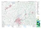
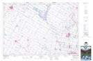
Maps showing Alma Station, Wellington, Ontario
Alma Station is a Unincorporated area located in Wellington, Ontario and has an elevation of 440 meters.
- Latitude: 43° 43' 30'' North (decimal: 43.7249999)
- Longitude: 80° 29' 42'' West (decimal: -80.4949999)
- Topography Feature Category: Unincorporated area
- Geographical Feature: Railway Point
- Canadian Province/Territory: Ontario
- Elevation: 440 meters
- Location: Wellington
- Atlas of Canada Locator Map: Alma Station
- GPS Coordinate Locator Map: Alma Station Lat/Long
Alma Station NTS Map Sheets