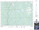
Maps showing Alma Lake, Timiskaming, Ontario
Alma Lake is a Lake located in Timiskaming, Ontario and has an elevation of 359 meters.
- Latitude: 47° 41' 2'' North (decimal: 47.6838888)
- Longitude: 80° 18' 34'' West (decimal: -80.3094444)
- Topography Feature Category: Lake
- Geographical Feature: Lake
- Canadian Province/Territory: Ontario
- Elevation: 359 meters
- Location: Timiskaming
- Atlas of Canada Locator Map: Alma Lake
- GPS Coordinate Locator Map: Alma Lake Lat/Long