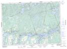
Maps showing Amburgs Reef, Peterborough, Ontario
Amburgs Reef is a Shoal located in Peterborough, Ontario.
- Latitude: 44° 33' 14'' North (decimal: 44.5538888)
- Longitude: 78° 29' 30'' West (decimal: -78.4916666)
- Topography Feature Category: Shoal
- Geographical Feature: Reef
- Canadian Province/Territory: Ontario
- Location: Peterborough
- Atlas of Canada Locator Map: Amburgs Reef
- GPS Coordinate Locator Map: Amburgs Reef Lat/Long
Amburgs Reef NTS Map Sheets