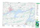
Maps showing Ameliasburg Mill Pond, Prince Edward, Ontario
Ameliasburg Mill Pond is a Lake located in Prince Edward, Ontario and has an elevation of 97 meters.
- Latitude: 44° 3' 45'' North (decimal: 44.0625000)
- Longitude: 77° 26' 00'' West (decimal: -77.4333333)
- Topography Feature Category: Lake
- Geographical Feature: Pond
- Canadian Province/Territory: Ontario
- Elevation: 97 meters
- Location: Prince Edward
- Atlas of Canada Locator Map: Ameliasburg Mill Pond
- GPS Coordinate Locator Map: Ameliasburg Mill Pond Lat/Long
Ameliasburg Mill Pond NTS Map Sheets