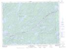
Maps showing Anchor Lake, Rainy River, Ontario
Anchor Lake is a Lake located in Rainy River, Ontario and has an elevation of 426 meters.
- Latitude: 48° 7' 38'' North (decimal: 48.1272222)
- Longitude: 91° 26' 44'' West (decimal: -91.4455555)
- Topography Feature Category: Lake
- Geographical Feature: Lake
- Canadian Province/Territory: Ontario
- Elevation: 426 meters
- Location: Rainy River
- Atlas of Canada Locator Map: Anchor Lake
- GPS Coordinate Locator Map: Anchor Lake Lat/Long