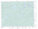
Maps showing Angler Falls, Thunder Bay, Ontario
Angler Falls is a Falls located in Thunder Bay, Ontario and has an elevation of 314 meters.
- Latitude: 48° 36' 1'' North (decimal: 48.6002777)
- Longitude: 85° 51' 43'' West (decimal: -85.8619444)
- Topography Feature Category: Falls
- Geographical Feature: Falls
- Canadian Province/Territory: Ontario
- Elevation: 314 meters
- Location: Thunder Bay
- Atlas of Canada Locator Map: Angler Falls
- GPS Coordinate Locator Map: Angler Falls Lat/Long
Angler Falls NTS Map Sheets