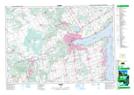
Maps showing Anten Mills, Simcoe, Ontario
Anten Mills is a Unincorporated area located in Simcoe, Ontario and has an elevation of 226 meters.
- Latitude: 44° 28' 56'' North (decimal: 44.4822222)
- Longitude: 79° 49' 45'' West (decimal: -79.8291666)
- Topography Feature Category: Unincorporated area
- Geographical Feature: Dispersed Rural Community
- Canadian Province/Territory: Ontario
- Elevation: 226 meters
- Location: Simcoe
- Atlas of Canada Locator Map: Anten Mills
- GPS Coordinate Locator Map: Anten Mills Lat/Long