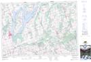
Maps showing Anthony Hill, Durham, Ontario
Anthony Hill is a Mountain located in Durham, Ontario and has an elevation of 301 meters.
- Latitude: 44° 14' 34'' North (decimal: 44.2427777)
- Longitude: 78° 34' 18'' West (decimal: -78.5716666)
- Topography Feature Category: Mountain
- Geographical Feature: Hill
- Canadian Province/Territory: Ontario
- Elevation: 301 meters
- Location: Durham
- Atlas of Canada Locator Map: Anthony Hill
- GPS Coordinate Locator Map: Anthony Hill Lat/Long