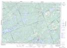
Maps showing Antoine Creek, Frontenac; Lanark, Ontario
Antoine Creek is a River located in Frontenac; Lanark, Ontario and has an elevation of 242 meters.
- Latitude: 44° 56' 33'' North (decimal: 44.9425000)
- Longitude: 76° 41' 14'' West (decimal: -76.6872222)
- Topography Feature Category: River
- Geographical Feature: Creek
- Canadian Province/Territory: Ontario
- Elevation: 242 meters
- Location: Frontenac; Lanark
- Atlas of Canada Locator Map: Antoine Creek
- GPS Coordinate Locator Map: Antoine Creek Lat/Long
Antoine Creek NTS Map Sheets