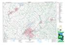
Maps showing Arkell, Wellington, Ontario
Arkell is a Unincorporated area located in Wellington, Ontario and has an elevation of 342 meters.
- Latitude: 43° 32' 11'' North (decimal: 43.5363888)
- Longitude: 80° 10' 4'' West (decimal: -80.1677777)
- Topography Feature Category: Unincorporated area
- Geographical Feature: Dispersed Rural Community
- Canadian Province/Territory: Ontario
- Elevation: 342 meters
- Location: Wellington
- Atlas of Canada Locator Map: Arkell
- GPS Coordinate Locator Map: Arkell Lat/Long