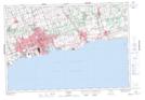
Maps showing Ashburn, Ontario, Ontario
Ashburn is a Unincorporated area located in Ontario, Ontario and has an elevation of 242 meters.
- Latitude: 44° 0' 9'' North (decimal: 44.0025000)
- Longitude: 78° 59' 43'' West (decimal: -78.9952777)
- Topography Feature Category: Unincorporated area
- Geographical Feature: Compact Rural Community
- Canadian Province/Territory: Ontario
- Elevation: 242 meters
- Location: Ontario
- Atlas of Canada Locator Map: Ashburn
- GPS Coordinate Locator Map: Ashburn Lat/Long
Ashburn NTS Map Sheets