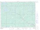
Maps showing Ashburton, Nipissing, Ontario
Ashburton is a Unincorporated area located in Nipissing, Ontario and has an elevation of 242 meters.
- Latitude: 46° 30' 59'' North (decimal: 46.5163888)
- Longitude: 80° 0' 54'' West (decimal: -80.0149999)
- Topography Feature Category: Unincorporated area
- Geographical Feature: Railway Point
- Canadian Province/Territory: Ontario
- Elevation: 242 meters
- Location: Nipissing
- Atlas of Canada Locator Map: Ashburton
- GPS Coordinate Locator Map: Ashburton Lat/Long