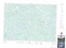
Maps showing Ashby Lake, Lennox and Addington, Ontario
Ashby Lake is a Unincorporated area located in Lennox and Addington, Ontario and has an elevation of 306 meters.
- Latitude: 45° 4' 59'' North (decimal: 45.0830555)
- Longitude: 77° 17' 19'' West (decimal: -77.2886111)
- Topography Feature Category: Unincorporated area
- Geographical Feature: Post Office
- Canadian Province/Territory: Ontario
- Elevation: 306 meters
- Location: Lennox and Addington
- Atlas of Canada Locator Map: Ashby Lake
- GPS Coordinate Locator Map: Ashby Lake Lat/Long