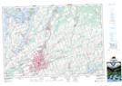
Maps showing Auburn Mills, Peterborough, Ontario
Auburn Mills is a Unincorporated area located in Peterborough, Ontario and has an elevation of 210 meters.
- Latitude: 44° 18' 57'' North (decimal: 44.3158333)
- Longitude: 78° 18' 29'' West (decimal: -78.3080555)
- Topography Feature Category: Unincorporated area
- Geographical Feature: Urban Community
- Canadian Province/Territory: Ontario
- Elevation: 210 meters
- Location: Peterborough
- Atlas of Canada Locator Map: Auburn Mills
- GPS Coordinate Locator Map: Auburn Mills Lat/Long
Auburn Mills NTS Map Sheets