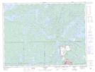
Maps showing Bagshot Bay, Rainy River, Ontario
Bagshot Bay is a Bay located in Rainy River, Ontario and has an elevation of 395 meters.
- Latitude: 48° 45' 56'' North (decimal: 48.7655555)
- Longitude: 91° 41' 2'' West (decimal: -91.6838888)
- Topography Feature Category: Bay
- Geographical Feature: Bay
- Canadian Province/Territory: Ontario
- Elevation: 395 meters
- Location: Rainy River
- Atlas of Canada Locator Map: Bagshot Bay
- GPS Coordinate Locator Map: Bagshot Bay Lat/Long