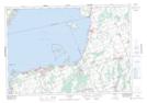
Maps showing Bald Point, York, Ontario
Bald Point is a Cape located in York, Ontario and has an elevation of 231 meters.
- Latitude: 44° 22' 8'' North (decimal: 44.3688888)
- Longitude: 79° 15' 40'' West (decimal: -79.2611111)
- Topography Feature Category: Cape
- Geographical Feature: Point
- Canadian Province/Territory: Ontario
- Elevation: 231 meters
- Location: York
- Atlas of Canada Locator Map: Bald Point
- GPS Coordinate Locator Map: Bald Point Lat/Long
Bald Point NTS Map Sheets