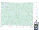
Maps showing Baldwin Depot Creek, Lanark; Renfrew, Ontario
Baldwin Depot Creek is a River located in Lanark; Renfrew, Ontario and has an elevation of 212 meters.
- Latitude: 45° 11' 29'' North (decimal: 45.1913888)
- Longitude: 76° 41' 31'' West (decimal: -76.6919444)
- Topography Feature Category: River
- Geographical Feature: Creek
- Canadian Province/Territory: Ontario
- Elevation: 212 meters
- Location: Lanark; Renfrew
- Atlas of Canada Locator Map: Baldwin Depot Creek
- GPS Coordinate Locator Map: Baldwin Depot Creek Lat/Long
Baldwin Depot Creek NTS Map Sheets