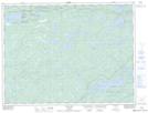
Maps showing Banning Narrows, Rainy River, Ontario
Banning Narrows is a Channel located in Rainy River, Ontario and has an elevation of 403 meters.
- Latitude: 48° 43' 54'' North (decimal: 48.7316666)
- Longitude: 92° 1' 7'' West (decimal: -92.0186111)
- Topography Feature Category: Channel
- Geographical Feature: Narrows
- Canadian Province/Territory: Ontario
- Elevation: 403 meters
- Location: Rainy River
- Atlas of Canada Locator Map: Banning Narrows
- GPS Coordinate Locator Map: Banning Narrows Lat/Long
Banning Narrows NTS Map Sheets