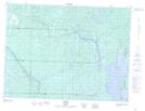
Maps showing Barrier Portage, Thunder Bay, Ontario
Barrier Portage is a Road feature located in Thunder Bay, Ontario.
- Latitude: 48° 57' 20'' North (decimal: 48.9555555)
- Longitude: 89° 51' 32'' West (decimal: -89.8588888)
- Topography Feature Category: Road feature
- Geographical Feature: Portage
- Canadian Province/Territory: Ontario
- Location: Thunder Bay
- Atlas of Canada Locator Map: Barrier Portage
- GPS Coordinate Locator Map: Barrier Portage Lat/Long