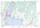
Maps showing Bayshore Village, Ontario, Ontario
Bayshore Village is a Unincorporated area located in Ontario, Ontario and has an elevation of 228 meters.
- Latitude: 44° 33' 20'' North (decimal: 44.5555555)
- Longitude: 79° 17' 5'' West (decimal: -79.2847222)
- Topography Feature Category: Unincorporated area
- Geographical Feature: Locality
- Canadian Province/Territory: Ontario
- Elevation: 228 meters
- Location: Ontario
- Atlas of Canada Locator Map: Bayshore Village
- GPS Coordinate Locator Map: Bayshore Village Lat/Long
Bayshore Village NTS Map Sheets