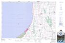
Maps showing Beach O'Pines, Lambton, Ontario
Beach O'Pines is a Unincorporated area located in Lambton, Ontario and has an elevation of 178 meters.
- Latitude: 43° 17' 36'' North (decimal: 43.2933333)
- Longitude: 81° 47' 21'' West (decimal: -81.7891666)
- Topography Feature Category: Unincorporated area
- Geographical Feature: Suburban Community
- Canadian Province/Territory: Ontario
- Elevation: 178 meters
- Location: Lambton
- Atlas of Canada Locator Map: Beach O'Pines
- GPS Coordinate Locator Map: Beach O'Pines Lat/Long
Beach O'Pines NTS Map Sheets