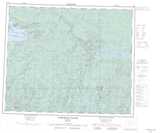
Maps showing Beardy Creek, Kenora, Ontario
Beardy Creek is a River located in Kenora, Ontario and has an elevation of 238 meters.
- Latitude: 53° 40' 21'' North (decimal: 53.6725000)
- Longitude: 89° 50' 2'' West (decimal: -89.8338888)
- Topography Feature Category: River
- Geographical Feature: Creek
- Canadian Province/Territory: Ontario
- Elevation: 238 meters
- Location: Kenora
- Atlas of Canada Locator Map: Beardy Creek
- GPS Coordinate Locator Map: Beardy Creek Lat/Long
Beardy Creek NTS Map Sheets