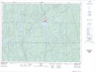
Maps showing Beaver Creek, Sudbury, Ontario
Beaver Creek is a River located in Sudbury, Ontario and has an elevation of 349 meters.
- Latitude: 47° 43' 15'' North (decimal: 47.7208333)
- Longitude: 81° 35' 29'' West (decimal: -81.5913888)
- Topography Feature Category: River
- Geographical Feature: Creek
- Canadian Province/Territory: Ontario
- Elevation: 349 meters
- Location: Sudbury
- Atlas of Canada Locator Map: Beaver Creek
- GPS Coordinate Locator Map: Beaver Creek Lat/Long