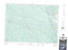
Maps showing Beech-drops Pond, Nipissing, Ontario
Beech-drops Pond is a Lake located in Nipissing, Ontario and has an elevation of 361 meters.
- Latitude: 45° 52' 1'' North (decimal: 45.8669444)
- Longitude: 77° 49' 48'' West (decimal: -77.8300000)
- Topography Feature Category: Lake
- Geographical Feature: Pond
- Canadian Province/Territory: Ontario
- Elevation: 361 meters
- Location: Nipissing
- Atlas of Canada Locator Map: Beech-drops Pond
- GPS Coordinate Locator Map: Beech-drops Pond Lat/Long