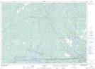
Maps showing Beeftea Creek, Sudbury, Ontario
Beeftea Creek is a River located in Sudbury, Ontario and has an elevation of 206 meters.
- Latitude: 46° 1' 35'' North (decimal: 46.0263888)
- Longitude: 80° 55' 1'' West (decimal: -80.9169444)
- Topography Feature Category: River
- Geographical Feature: Creek
- Canadian Province/Territory: Ontario
- Elevation: 206 meters
- Location: Sudbury
- Atlas of Canada Locator Map: Beeftea Creek
- GPS Coordinate Locator Map: Beeftea Creek Lat/Long