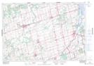
Maps showing Beeton, Simcoe, Ontario
Beeton is a Unincorporated area located in Simcoe, Ontario and has an elevation of 238 meters.
- Latitude: 44° 4' 57'' North (decimal: 44.0825000)
- Longitude: 79° 47' 12'' West (decimal: -79.7866666)
- Topography Feature Category: Unincorporated area
- Geographical Feature: Urban Community
- Canadian Province/Territory: Ontario
- Elevation: 238 meters
- Location: Simcoe
- Atlas of Canada Locator Map: Beeton
- GPS Coordinate Locator Map: Beeton Lat/Long
Beeton NTS Map Sheets