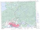
Maps showing Bellevue, Algoma, Ontario
Bellevue is a Unincorporated area located in Algoma, Ontario and has an elevation of 345 meters.
- Latitude: 46° 42' 16'' North (decimal: 46.7044444)
- Longitude: 84° 13' 32'' West (decimal: -84.2255555)
- Topography Feature Category: Unincorporated area
- Geographical Feature: Railway Point
- Canadian Province/Territory: Ontario
- Elevation: 345 meters
- Location: Algoma
- Atlas of Canada Locator Map: Bellevue
- GPS Coordinate Locator Map: Bellevue Lat/Long
Bellevue NTS Map Sheets