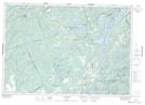
Maps showing Bellheck, Lennox and Addington, Ontario
Bellheck is a Unincorporated area located in Lennox and Addington, Ontario and has an elevation of 179 meters.
- Latitude: 44° 31' 13'' North (decimal: 44.5202777)
- Longitude: 76° 57' 50'' West (decimal: -76.9638888)
- Topography Feature Category: Unincorporated area
- Geographical Feature: Dispersed Rural Community
- Canadian Province/Territory: Ontario
- Elevation: 179 meters
- Location: Lennox and Addington
- Atlas of Canada Locator Map: Bellheck
- GPS Coordinate Locator Map: Bellheck Lat/Long