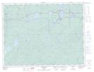
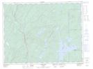
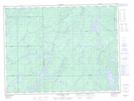
Maps showing Bertrand Creek, Thunder Bay, Ontario
Bertrand Creek is a River located in Thunder Bay, Ontario and has an elevation of 340 meters.
- Latitude: 48° 42' 41'' North (decimal: 48.7113888)
- Longitude: 85° 33' 17'' West (decimal: -85.5547222)
- Topography Feature Category: River
- Geographical Feature: Creek
- Canadian Province/Territory: Ontario
- Elevation: 340 meters
- Location: Thunder Bay
- Atlas of Canada Locator Map: Bertrand Creek
- GPS Coordinate Locator Map: Bertrand Creek Lat/Long
Bertrand Creek NTS Map Sheets