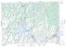
Maps showing Bexley, Victoria, Ontario
Bexley is a Geographical area located in Victoria, Ontario.
- Latitude: 44° 38' 25'' North (decimal: 44.6402777)
- Longitude: 78° 53' 35'' West (decimal: -78.8930555)
- Topography Feature Category: Geographical area
- Geographical Feature: Geographic Township
- Canadian Province/Territory: Ontario
- Location: Victoria
- Atlas of Canada Locator Map: Bexley
- GPS Coordinate Locator Map: Bexley Lat/Long
Bexley NTS Map Sheets