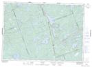
Maps showing Big Bear Island, Frontenac, Ontario
Big Bear Island is a Island located in Frontenac, Ontario and has an elevation of 263 meters.
- Latitude: 44° 55' 40'' North (decimal: 44.9277777)
- Longitude: 77° 11' 31'' West (decimal: -77.1919444)
- Topography Feature Category: Island
- Geographical Feature: Island
- Canadian Province/Territory: Ontario
- Elevation: 263 meters
- Location: Frontenac
- Atlas of Canada Locator Map: Big Bear Island
- GPS Coordinate Locator Map: Big Bear Island Lat/Long