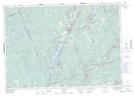
Maps showing Big Bob Dam, Haliburton, Ontario
Big Bob Dam is a Hydraulic construction located in Haliburton, Ontario and has an elevation of 316 meters.
- Latitude: 44° 53' 34'' North (decimal: 44.8927777)
- Longitude: 78° 47' 26'' West (decimal: -78.7905555)
- Topography Feature Category: Hydraulic construction
- Geographical Feature: Dam
- Canadian Province/Territory: Ontario
- Elevation: 316 meters
- Location: Haliburton
- Atlas of Canada Locator Map: Big Bob Dam
- GPS Coordinate Locator Map: Big Bob Dam Lat/Long